Your browser is out of date.
This site may not function properly in your current browser.Update Now
The configurable map embed tool makes it easy to create a very powerful map and then embed it into your site. Here is an example of the famous Pikes Peak Highway that reaches the 14,115' (4,302m) mountain summit.
Digital maps have become an essential service of the internet. A study released by MIT in 2019 determined that users value digital maps as the third most important service of the internet—behind only search and email.
Whether you are in tourism, parks and recreation, community planning, real estate, conservation, or any other field that involves communicating place-based information, you should be showing and not just telling. Interactive maps are an important tool for communicating place and showing.
You'll notice a helicopter icon at the top left of each map. Go ahead and try out the animated fly-through!
Go ahead and use this map. It's interactive!
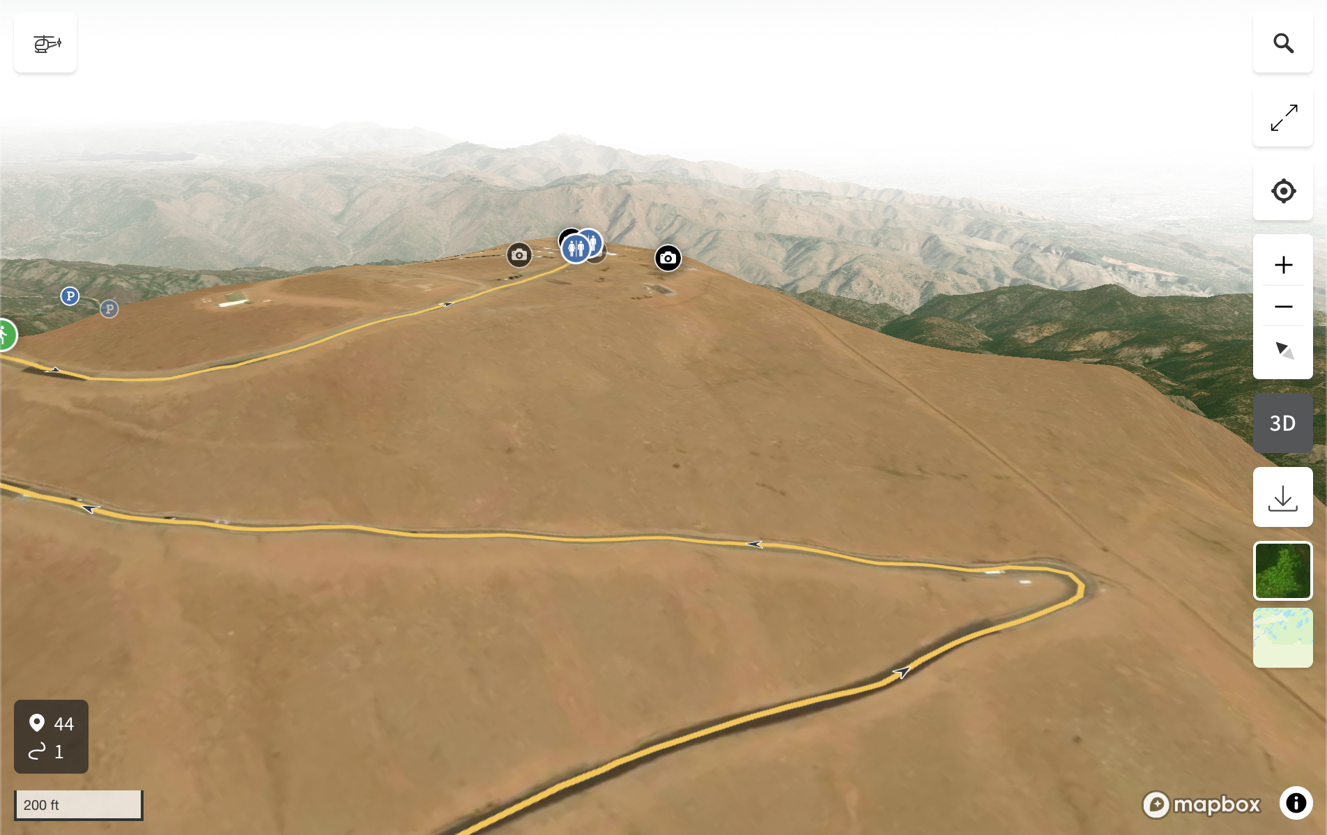
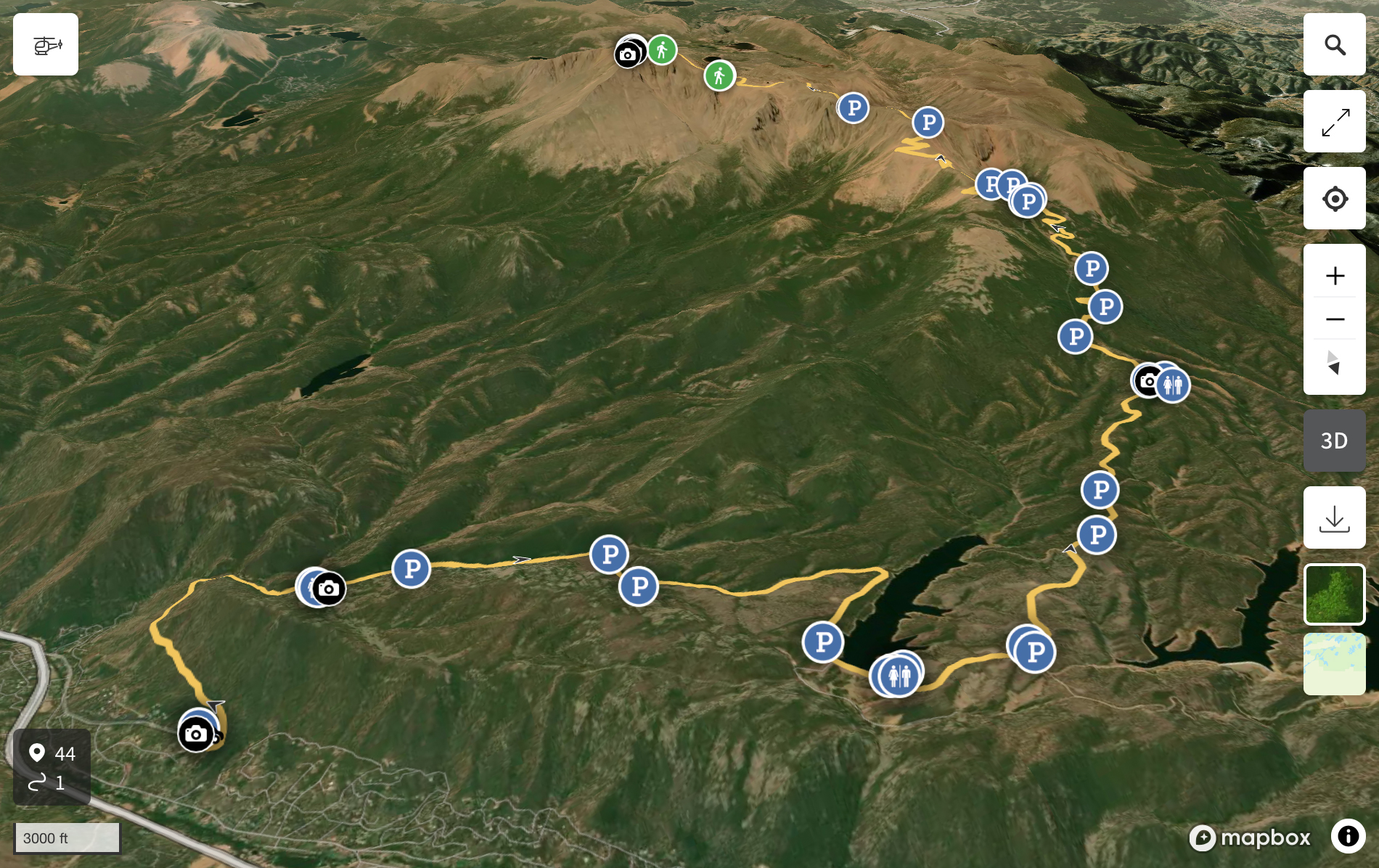
The embed tool also enables you to save specific map perspectives and embed it into your site. For example, you might have a route that you want to detail in a blog and describe various points along the route. You can adjust the 3D map to best represent what you are describing and embed that specific perspective.
Here are two different perspectives that have been saved from the same map that is embedded above. I have turned on the 3D option, selected the satellite imagery basemap, and then rotated the map to the precise view perspective that I think represents the final peak section of the road:
| Perspective Example 1 | Perspective Example 2 |
|---|---|
 |
 |
Go ahead and use this map. It's interactive!
Go ahead and use this map. It's interactive!
More about this topic:
• Does Your Community Trail and Park System Need to be Better Documented?